Recent searches
Search options
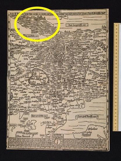
Produced as a woodcut, i.e. the details cut into a block of wood before printing, the map was always in the same size and format as the very wood block used: 41 x 29 cm in stereographic projection to a scale of about 1:5,600,000.
Have a look at the map yourself: https://digital.bodleian.ox.ac.uk/objects/9a239e34-a3f9-4914-ab93-cc982cb944a0/
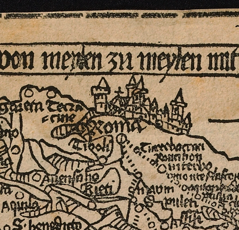
The dots used on the map are mile-indicators for actual travelers to Rome - or for travelers of the mind.
#MapHistory #BookHistory #histodons
2/4


